My visit to Denmark
**Spoiler Alert**
This post contains spoilers – please don’t continue reading if you have not previously read The Flight of the Shearwater, the second book in the Sturmtaucher trilogy. You have been warned!

When I’d flown into Hamburg on my 2017 research trip, and picked up my little hired Fiat 500, I hadn’t headed straight for Kiel. I knew that part of my story would take place in Denmark, and I was on the hunt for a very specific location where a yacht could find shelter from a savage North Sea storm, out of sight of the German authorities occupying Denmark.
After a painstaking search, I thought I’d found the ideal place on Google Earth, but I wanted to make sure so, after a short detour to view the western sea locks of the Kiel Canal at Brunsbuttel, where it meets the River Elbe, and its access to the North Sea, I drove through the incredibly flat terrain of northern Germany and southern Denmark in the dying light, finally arriving at the port of Esbjerg on Denmark’s west coast, where I’d booked a room.


Fortunately, the rain had cleared by the morning, and it was a pleasant autumn day. I had a quick look around Esbjerg harbour – I knew the lightship that marked the end of Horns Rev, a long reef that extends over 20 miles from Blavlands Huk, or point, out in to the North Sea, had been preserved, and lay in the Harbour for tourists to explore.

The treacherous sandy reef was to play a significant part in the book.
To my disappointment, the floating lightship museum wasn’t open, so I jumped back in my little Fiat, and headed northwards, following the road out of Esbjerg, through Oksbøl and Børsmose, the roads getting narrower as they approached the dunes beyond Kærgård. A rutted lane ending in sandy open circle brought me to my next destination. I could hear the sea, but I couldn’t see it, although I couldn’t miss the large tripod Kærgård sea mark, looking for all the world like an alien machine from War of the Worlds, high on the dunes above me.


I climbed the sandy path through the scrub and tall Marram Grass, cresting the forty foot dune to find the North Sea surf crashing on the beach below, at the point where Der Sturmtaucher, with Franz, Johann, Ruth and Manny aboard, would make landfall in their search for Blavland lighthouse. The innermost marker of Horns Rev, it’s light would guide them through the storm to the entrance of Graa Dyb channel, and the sheltered waters of Ho Bught, Esbjerg and, more importantly, Ho Dyb, and its narrow tidal cuts among the marshlands behind the dunes of Skallingen.
Getting back in the car, I followed the narrow roads through the sandy, forested heathlands behind the dunes, looking for the next seamark and, as I passed through the campsite that now shelters behind the dunes, I could see the Ringebjerg Beacon clearly in the distance. Like Kærgård, it stood on three legs, a tripod with a diamond shape. Both structures are part of a chain of navigational mark that stretch all the way up the Jutland coast, and were erected in the late 1800s. They are all now protected monuments.

I could have easily walked from Ringebjerg to Blavlands Huk, or point, but time was short so I drove an inland loop round to the car park next to the lighthouse. It was this light, and the one that once mark the tip of Skallingen, that Franz and Johann would use to navigate their way to safety at the height of the storm that almost drowned them.

From Blavlands point, I could see the troubled waters of Horns Rev stretching out far into the North Sea, the swirling currents a combination of tidal flow through the narrow channels of the reef, and the current flowing northwards from the Wadden sea, the coastal strip of water and islands that are the south-eastern limits of the North Sea, part salt, part fresh, from the large rivers, including the Elbe, which pour into it.

I imagined the two terrified Nussbaums watching Franz and Johann wrestle their small craft through the crashing waves of the reef, threading their way through Søren Bovbjergs Dyb, the narrow break in the sandbanks that cut twenty horrendous sea miles from their passage to shelter.

Once through it, they had searched for the lighthouse at the tip of Skallingen, the four mile long spit of sand dunes that protected Ho bucht and Ho Dyb from the ravages of the North Sea.
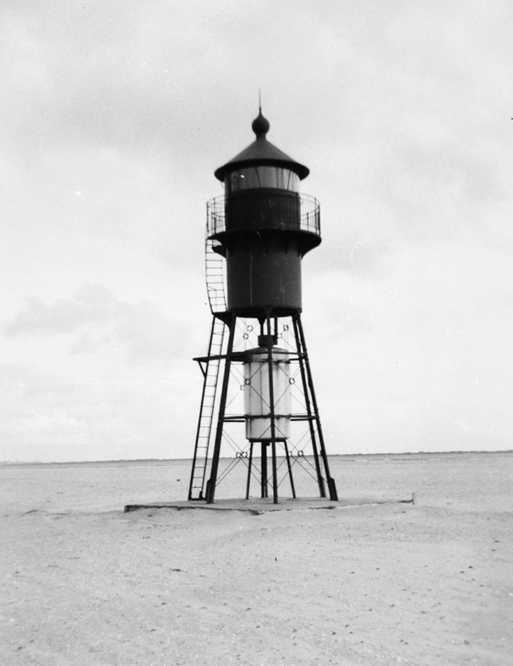
As I drove through the village of Ho, and out the single track road that took me to the car park half way along Skallingen, I knew I wouldn’t see the lighthouse – it had been removed in 1966 after subsiding foundations had caused it to collapse. The lightweight Iron Structure had replaced a substantial brick tower which had also collapsed, the perils of building on foundations of sand.


I had to walk the last mile or so as the track wasn’t suitable for road vehicles (though I would have given it a go if it hadn’t been a hire car).

At the tip of Skallingen the dunes gave way to a half mile long low spit of sand and, standing at the water’s edge near to low tide, I could just make out the island of Fanø with it’s off-lying sandbanks on the other side of Graa Dyb. A ship passed by, heading out from Esbjerg, heading south and west, and I waved at its bridge. I couldn’t say for sure, but I thought my salute was returned.


Turning landward, I could make out the narrow Ho Dyb channel that curled around the back of Skallingen, between it’s dunes and marshes and the low lying Island of Langli opposite, with its tail of sandbanks that guarded its entrance.
I imagined the calm that would welcome any boat brave enough to tuck itself into Hobo Dyb during the worst of storms. The only question I had was whether the boat would be hidden well enough to escape notice from the German authorities, so I retraced my steps along the track to the car, and drove the short distance to a bend in the road close to where I imagined Der Sturmtaucher would come to a rest if she’d made it to safety. I looked towards Ho Bught, but I couldn’t see Langli, far less Hobo Dyb.
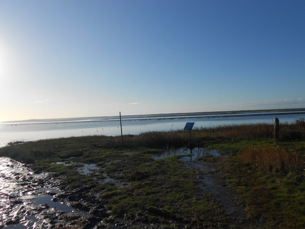
I climbed the fence and made my way cautiously across the rough grassy hillocks, careful to avoid the odd mud filled hole that, as I ventured further towards the channel, began to coalesce into trenches, then water filled creeks. I looked around anxiously: I was on my own, with few people about, and it would be extremely perilous to get bogged down in one of these foul-smelling pits.
Even as the cut I was following opened out into a small, muddy, tidal creek, I still couldn’t see anything beyond the tall marsh grasses and I stopped, knowing that such a creek was an almost perfect hiding place for a wooden yacht, invisible from the road and the main channel.

Reaching the road again, I breathed a sigh of relief at having avoided being trapped in the mud. I drove back along Skallingen towards Ho, stopping when I reached the forest. Parking the car once more, I followed the edge of the forest around the top end of Hobo Dyb on foot. It was rough going, but dryer, and I could now see Langli, with Ho Bught beyond, and Hobo Dyb itself. I reached the small road which led around the shoreward side of the wood towards Ho. I looked out – the start of the rough causeway which could be supposedly traversed at low tide to get to Langli disappeared into the water and I didn’t fancy the walk or drive across it to get to the island, even if I had been there at low tide.


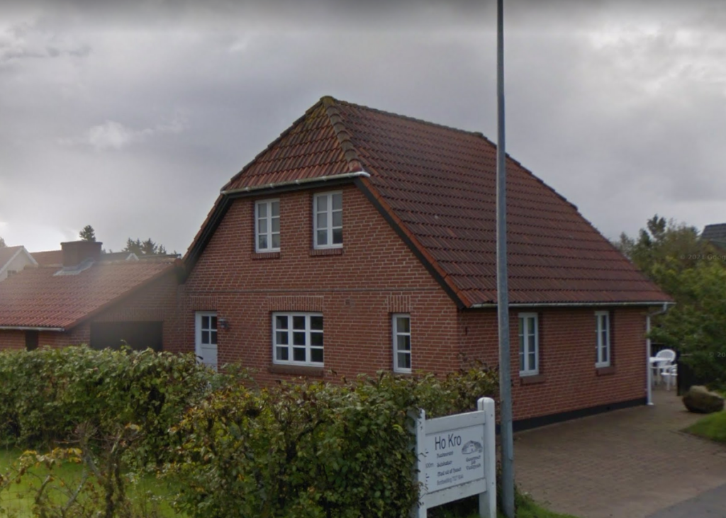
I followed the road around towards Ho but before I got to the village itself, I reached the road to Skallingen again. I looked around. I’d passed a golf course on my walk, and there were a modest number of what looked like holiday homes scattered within the forest, and at its edge. Most were modern but, as I approached Ho, there were some older looking houses among them. Back in 1941, they were probably all small farmhouses, surrounded by fields. In my imagination, the Danish farmers who provided help and shelter to Johann and Manny lived in one of these houses, working the land and fishing in the waters of Ho Bught and Hobo Dyb.

Walking back along the road to Skallingen to my Fiat 500, through the beautiful pine forest, a car slowed down and a Danish couple, with excellent English and a dog in the back, stopped and offered me a lift. They were locals, and were intrigued when I told them I was researching for a wartime book. They were intensely proud that almost all of Denmark’s Jews had survived the Holocaust.
Wishing me good luck with my writing, they drove off – I presumed for a walk along the dunes. I took one last look out at the North Sea and closed my eyes, imagining Der Sturmtaucher sailing out of Graa Dyb with the fog to hide them, heading westward for the east coast of England, and safety for Ruth and Manny, imprisonment for Franz and Johann.

I told myself that one day, I would follow their route, sailing from Kiel to Hobo Dyb, and onwards across the North Sea, but for now, I turned away and walked back down the dunes.
I got back into the car. I had a long way to go, and a few more stops to make.
I wanted to see the Little Belt, or Lillebælt, the westernmost of the three straits that connects the Baltic sea with the Kattegat and Skagerrak, and through them, the North Sea.
It was just over an hour’s drive across to Denmark’s other coast, to Middlefart and the old Bridge which crosses the Little Belt at its narrowest point. I’d studied the three routes Der Sturmtaucher might take from Kiel to Northern Denmark, and I’d decided the tighter, most difficult one close to the mainland would be their passage of choice, with less marine traffic, and a number of quiet harbours and anchorages where Ruth and Manny Nussbaum could remain undiscovered. I didn’t have time to visit the other stops on their journey; Hirtshalls, Laeso, Hjelm, Bogense and Bodjen, but when I looked out across the Middlefart Narrows, I felt that it was the right choice to have them follow the quieter channel. I looked over to the small town of Middlefart on Fyn, one of the large islands that make up almost a third of Denmark’s land area.

I saw the narrow stretch of water, with the bridge and the small harbour opposite as somewhere Der Sturmtaucher might be stopped and searched on its way north with its illegal passengers on board, hiding in the bilges.
I didn’t stay long. The light would fade soon and I had a few more stops on the way to Kiel. I didn’t have to detour much from my route – Flensburg, Schleswig and Rendsburg were all on the road to my final destination.
Flensburg and Schleswig were much as I’d pictured them, both beautiful small waterside cities, their architecture largely unaffected by war, unlike Kiel. I had planned small cameo appearances for both places in the book, but neither would feature significantly.


It was the same with Rendsburg. Situated beside the Kiel Canal, with an offshoot, the Ober Eider, swinging right into the centre of town, the canal that made the inland city a port would play a bigger part in the book, and having seen the western sea locks at Brunsbüttel, and hoping to see the sea locks at Kiel, I wanted to see an inland section of this remarkable waterway, with no other locks along its 61-mile length.

The light was failing but, from Rendsburg, it was only a forty-minute drive to Kiel. Even so, I wanted to get there as sharply as possible to get something to eat and a few drinks down by the water front, to get an idea of night-time Kiel, and to get an early bed; the next few days would be full-on if I was going to see everything I wanted to in and around the city where the bulk of the Sturmtaucher Trilogy was set.

THE LIE OF THE LAND, Part 1 – My visit to Kiel, 2017
THE LIE OF THE LAND, Part 2 – My visit to Kiel – the suburbs and surrounding areas
More detailed maps, and the routes the characters travelled can be found on the website, and you can download my route through Denmark on Google Maps
Really interesting. I have done some oil-related work in Esbjerg and sailed through the Limfjord from West to East in 2000.
Rory, would love to recreate their journey one day, and also do Limfjord and the Swedish Archipelago. Would be good to do it in a gaff-rigged ketch! Esbjerg looked very commercial, but Hobo Dyb and Skallingen were wild and unspoiled.