For a writer, there is a special thrill when a reader is inspired to be creative after finishing one of their books, especially when it happens twice.
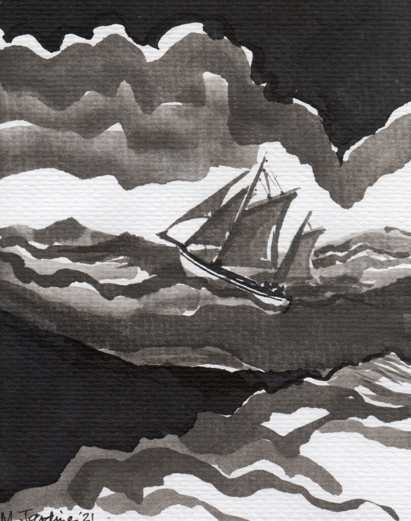
I’d already posted a painting of Der Sturmtaucher, the gaff-rigged ketch which has a central role in The Flight of the Shearwater, sent to me by Mark Jardine, one of my beta-readers, and the owner of a working gaff-rigged ketch called Birthe Marie, a converted traditional Danish fishing boat which he uses to sail visitors around the beautiful islands of Mull and Iona on Scotland’s stunning west coast.
Der Sturmtaucher in the North Sea, Mark Jardine
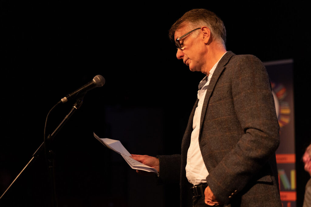
Then, in September this year, William A McMillan was one of the poets reading at an event at the Tidelines Book Festival in Irvine, where I also did a reading from The Sturmtaucher Trilogy. It was a reunion of sorts, but we hadn’t seen each other for a decade. so it was lovely to catch up.
William A McMillan reading at the Tidelines Festival
We chatted about my books, his poetry and his art, much of it centred around wildlife and the countryside of South Ayrshire. It was a pleasant surprise to discover our respective new ‘careers’.
Then, towards the end of November, he got in touch saying that he’d been inspired by reading the Sturmtaucher Trilogy to write a poem about a Manx Shearwater, the seabird that runs as a theme through the Sturmtaucher Trilogy (Sturmtaucher is German for Shearwater), in Antje Kästner’s art, in the sailing passages in the North Sea, and in the gaff-rigged ketch named for it.
He’d also done a drawing of a shearwater to accompany the poem. Here is the poem, and the picture.
Shearwater
Gliding low over rising tides
Swooping through scooped out troughs of air
That run beneath the soaring sides
Of mountainous wave crests growing there
Sheer walls of water shall be your home
Cutting your way through the ocean’s grain
Journeying forth by the green spume foam
The shearwater flies, far from safe nests
From cradled burrow to watery grave
The wanderer ploughs on, alone
Her life, an endless long-distance race
Stark sentinel in a timeless place
A streamlined vision of nature’s grace
The salt-laden miles are her dominion
The wind and the weather her constant companion
Crying her song to the fathomless ocean
Surfing the churn of the water’s swift motion
Never halting, never ceasing
She glides out her life in headlong flight
Wing tips circling the depths of night
Drawn by some instinct within her soul
That points her to home where the breakers roll
At last, to the cliff by the soft grass furrow
And the quiescent peace of her own safe burrow
William A McMillan
Manx Shearwater. William A McMillan
Many thanks to William for allowing me to post both the poem and the drawing, and to Mark Jardine for giving kind permission to reproduce his painting.
You can see further examples of William’s artwork, photography and poetry on his Facebook page.
Myvisit to Kiel – The suburbs and surrounding areas
After walking around Kiel for a day, and treating myself to a ‘Hearty Tavern Pan’, as Google translated it, a tasty meal of meat loaf, two types of Würstchen in a beer sauce, and fried potatoes, washed down with a couple of beers, I slept well, rising early to catch one of the first ferries that set sail from Bahnhofsbrücke, the pier near the station.
Deftige Wirtshauspfanne (Hearty Tavern Pan)
The Laboe Ferry called in at various points on both sides of Kiel Hafen on the way to its final destination, almost at the mouth of Kieler Förde where it opens out into the Ostsee, or Baltic Sea.
Ferry Bahnhofsbrücke [1] River Schwentine [2] Site of naval dockyard[3] Mönkeberg [4] Heikendorf [5] Freidrichsort Lighthouse [6] Laboe [7] U-boat memorial [8] Freidrichsort [9] Kiel Canal entrance Car [10] Kleiner Kuhberg [11] Nussbaum apartment, Gaarden [12] Ellerbeck [13] Wellingdorf [14] River Schwentine [15] Deitrichsdorf [16] Hamburger Strasse [17] Drachensee [18] AEL Nordmark [19] Holtenau locks, Kiel canal [20]
As we pulled away from the dock, the sun broke through the clouds and lit up the church towers on one side, and the shipyard cranes on the other. The city centre, around the Innerhafen, is low and flat and only the waterfront buildings were visible but, as we passed the Fischhalle on our port side, and the Arsenal Mole on the starboard, the land behind the west shore began to rise a little; the parks and suburban homes of Dusternbrooker were a backdrop to the former Kriegsmarine HQ and Imperial Yacht club on the foreshore.
Former Naval HQ
On the starboard side, the naval shipyard gave way to the entrance to the River Schwentine, the inlet lined with smaller boatyards on one side, and apartment blocks and parkland on the other, with a marina at its head, near to the Schwentine bridge.
Schwentine
North of the Schwentine, cruise ships and ferries lined the wharfs, instead of the naval ships that victualled there during WW2. The oiling jetties and the moles of 1939 would be a significant part of the trilogy.
Then, as Kieler Förde opened out, and the ferry hugged the east shore, Kiel’s heavy industry gave way to the trees and small sandy beaches of Hasselfelde and Mönkeberg.
Hasselfelde Strand
Rounding the point at Heikendorf, where Erich Kästner had watched Der Sturmtaucher sail towards the Marine Barrier in Flight of the Shearwater, I could see Friedrichsort lighthouse ahead, at the end of the spit of land jutting out into the Förde, narrowing it to less than a kilometre again, protecting Kiel Hafen from the worst of the Baltic storms, making it one of the largest and safest harbours in the world.
Passing the lighthouse, which Erich and his friends had sailed to blindly in The Gathering Storm, emerging from the fog just as the lighthouse came into view, I could see Laboe ahead, with it’s yacht marina, small harbour and strand, or beach, stretching out as the land curved round to become the Baltic shore. In the 1930s, the harbour brimmed with fishing boats and the ferry docked on the inner pier.
Laboe, with the U
In the distance, the Laboe U-boat memorial, dedicated to submariners killed in the First World War, rose 85 metres into the air, the highest point for miles around. At its base, a restored WW2 submarine, U-995, is open to the public. I’d like to have added it to my itinerary, but I knew that time was limited and there were more pressing places to visit.
Laboe U-boat memorial
This was as far north as the ferry took us, and I stayed on for the return journey. As we left Laboe, across to the west, at Schilksee, I could just make out the Olympic Marina. The games came to kiel in 1936 and again in 1972. The medals for the larger boats were fought out on the course between Freidrichsort and the mouth of the Förde. The races for the smaller classes took place in the more sheltered waters closer to Kiel.
Poster for Olympic sailing competition, 1936, Kiel
The Ferry called in at Friedrichsort then, heading back to Kiel, it took us closer to the entrance to the Kiel Canal (The Kaiser-Wilhelm Canal prior to 1948), one of the busiest man made waterways in the world. It features in the book, most notably when the General’s yacht passes through it on the way to the North Sea, taking his youngest daughter Antje sailing there for the first time.
Entrance to Kiel Canal, from Kieler Förde
Approaching Die Hörn again, and the Keil waterfront, with ships and boats of all varieties, commercial, leisure and naval, I began to appreciate just how much Kiel was first and foremost a port, and how important sailing and seafaring was to the city’s lifesblood, and how well it suited my story.
But there was more I wanted to see.
I’d hired a car when I landed in Hamburg, visiting Denmark for a couple of days before arriving in Kiel. I retrieved the car from the car park I’d abandoned it in and followed the road around end of Kiel Hafen to the Gaarden district of Kiel, on the east side of the harbour.
Adjacent to the shipyards, the districts of Gaarden, Wellindorf and Dietrichdorf had been severely damaged in the allies attempts to shut down production of ships and submarines from the Keil yards, and to prevent repair of any damaged vessels. I wasn’t expecting to find much of the ‘old Kiel’, but the odd building, such as this one on the corner of Preetzer Chaussee and Ostring, had survived.
Preetzer Chaussee
I stopped at the side of the road and tried to imagine the thousands upon thousands of platers, drillers, riveters, boilermakers and fitters streaming throught the high gates of the shipyards building the battleships, destroyers and U-boats for the rapid expansion of the Third Reich’s navy, some of slave-labour from the work camps located close by, and of the death and devastation that decimated the shipyards and the surrounding districts, and the men women and children lost to the brutality of war.
Kiel naval dockyards, 1945
Deep in thought, I followed the map, turning right off the main road, almost forgetting to drive on the right. A few blocks on, rounding the corner, I was in Stoschstraße, where Samuel and Renate Nussbaum, Yosef’s parents, lived.
I had a scene in my mind, of a woman walking these streets with her children, looking over her shoulder in fear as the black cars and the brown uniforms of the SA scoured the streets for Jews.
Stoschstraße
A mixture of buildings had survived, facades had been saved and new apartment blocks built with a similar footprint, and it made the street remarkably familiar. A childhood memory of walking down a similar street to catch a glimpse of the QE2 being launched burst into my mind, and I realised that Stoschstraße could be any street in Govan, or Partick in Glasgow, close to where the Clyde shipyards once dominated the city, and I began to feel more of a sense of Kiel as a shipbuilding town.
By the time I’d reached the River Schwentine, crossing from Wellingdorf over to Deitrichsdorf, the sun was splitting the skies and I stopped at the Schwentinetalfahrt, where you could hire small punts to explore the Schwentine river, or take a trip in one of the small tourist boats.
Schwentine
I didn’t stop long – I wanted to see where the wartime naval victualling yard had been – it would become a key location in the trilogy, but none of it remained – instead of the oiling jetties and loading moles, there was a ferry berth and a cruise ship terminal, but Heikendorfer Weg still passed by where the dockyard entrance would have been.
I took the ring road back, for quickness, exiting it at Hamburger Chaussee, the main route to Hamburg before Autobahns were built in the 1930s. I’d found the ideal location for the Kästner home on Google Earth, on the shores of a small lake, Drachensee, on the outskirts of Kiel. A couple of larger lakeside houses sat at the side of Hamburger Chaussee, their wooded gardens running down to the water’s edge, with boathouses, and I could just imagine Admiral Kästner and his family, then his son, General Erich Kästner, living there, sailing small dinghies on the lake in summer; the Nussbaums, their domestic servants, living in a cottage in the grounds. I parked the car and walked along, catching only a glimpse of the lake through the trees, but it was perfect. The house I had in mind for the Kästner’s neighbours, Eberhard and Beate Böhm, and their daughter, Lise, was as it had been in 1933, at the start of the Trilogy.
Hamburger Chaussee, Drachensee & the Böhm house
Leaving Drachensee, I drove on out to Schulensee, the source of domestic water for the residents of Kiel, and turned right, heading for Hassee and Russee, on the main Rendsburg road. I parked in the supermarket car park and walked down by the sports ground to the side of another lake, Russee, slightly larger than Drachensee and on whose shores sat the Nazi ‘educational’ work camp, Arbeitserziehungslager Nordmark.
AEL Nordmark punishment bunker AEL Nordmark memorial
A concentration camp in all but name, and run by the Gestapo, there was little left, save for a small memorial erected in a clearing, for the German and foreign slave workers who had been sent there to punish them for slacking, or other misdemeanours, and to re-educate them to be ‘model workers’. They died in their thousands in AEL Nordmark, though few people know the history of these camps, which existed in every corner of Nazi Germany.
Russee, with AEL Nordmark Memorial markedAEL Nordmark plan, superimposed
Although it was a warm day, I shivered as I returned to my car.
I had one last place I wanted to see, a drive northwards to Holtenau, and the locks at the entrance of the Kiel canal. The locks, and the canal, were massive, and I imagined the Kästner family on their sailing trip to the North Sea, and the islands of Wangerooge, Heligoland and Föhr.
Yacht dwarfed in Holtenau lock
I drove back through Wik and the northern suburbs of Kiel, returning to my room in Lange Reihe, to collect my bags, heading for Hamburg and my flight home. I took one last look at Kieler Hafen as I drove along Kaistraße, and made for the Autobahn.
Route map in ‘old money’
More detailed maps can be found on the website and you can download my route on Google Maps. I’ll be posting about the other part of my trip, to Esbjerg in Denmark. I travelled there before I went to Kiel, but it does contain some spoilers, so I’ve left it until last, and the parts of the trilogy that take place there are much further on in the story.
When I started researching the Sturmtaucher Trilogy back in late 2016, I was dismayed to find that, unlike most countries in Europe, Germany did not allow Google to roll out Streetview. At a stroke, my ability to walk the streets of Kiel and other parts of Germany from the comfort of my writing chair had gone, and while maps and old photographs were abundant and helpful, with a bit of digging, it was harder to get a real sense of the locations I was looking for as I plotted my story.
Europe. Only Belarus is as bereft of the dark green of Google’s Streetview as Germany.
In 2017, I visited Northern Germany to try and get a handle on the city that would become the centre of my life for the next five years, to get my head around its topography, and that of the countryside around it.
I also wanted to speak to the people who lived there, and walk the streets to see if any of the buildings that I’d located using 1930-40s maps and photographs were still there.
Holtenauerstraße, Kiel, in 1935, 1945 and 2015
I knew that large swathes of Kiel had been decimated during the latter part of WW2, and that the many of the buildings I wanted to describe had gone forever; the centre of Kiel is largely a new city, arising from the ashes of the old one, and when I arrived, I found it more difficult than I imagined to place myself in the 1930s streets when modern roads and concrete buildings surrounded me.
Then I’d turn a corner and fragments of the old Kiel I’d seen in the photographs would emerge; the occasional row of apartment blocks that had survived; a church, a junction, an avenue of trees, and most of all, the parks and open spaces that had always been there for the citizens of Kiel.
I’d obtained a scan of a British Army map of Kiel from the 1940s in the British Library, with many of the major buildings, factories and utilities identified. I plotted a route on it of all the places I wanted to visit, and wondered how that would translate to modern-day Kiel. With surprisingly few minor detours, I could walk the same route!
[Start] Lang Reihe [1]Judenhaus, Kleiner Kuhberg [2] Rathaus, Ratskeller [3] Kleiner Kiel [4] Städtische Sparkasse [5] Schreventeich [6] Synagogue [7] Weichmann flat, Jungman Straße [8] Holtenauerstraße [9] Gestapo HQ [10] Flandernbunker [11] Tirpitzhafen [12] Oskar’s house [13] Imperial Yacht Club [14] Kriegsmarine HQ [15] Kielline [16] Schifffahrtsmuseum [17] Kiel Banhof [18] The Jewish cemetery
I left my rented room in Lang Reihe, where, in the trilogy, Lise and Rudolf Mey would have their first flat, and strolled the short distance to Kleiner Kuhberg, the location of the Judenhaus that housed Kiel’s remaining Jews before they were deported east, to the Ghettos and camps of Poland and Latvia. Despite the shopping centre opposite, a few of the buildings on the other side of the street had just about survived, unlike the Jews who had lived there, and I could feel the past seeping into my bones.
Kleiner Kuhberg in 1930 and in 2017
FromKleiner Kuhberg, at the corner of Exerciserplatz, I took a right and headed for the Rathaus, the City Hall. A shell in August 1945, it has since been restored to its former glory. I took a table on the terrace outside the Ratskeller and sat overlooking the town square, renamed Adolf-Hitler-Platz during the National Socialist era.
Kiel Rathaus
As I sipped my coffee, it struck me that it looked much the same as in the photograph I’d found of the National Socialist rally in March of that year, where, in The Gathering Storm, Erich Kästner would listen as ‘Stirring words of hate rained down on the crowd from the Rathaus’s balcony to a frenzied clamour of acclaim’.
Kieler Leben, 11th March 1933
I strolled around the pleasant waters of Kleiner Kiel, as the people of the city had done for centuries, crossing the bridge, now more of a causeway, that separated its two small lakes.
The twin lakes of Kleiner Kiel
On its northern shore, in Lorentzendamm, I stopped in front of the City Savings Bank.
Städtische Sparkasse, 2017
The Städtische Sparkasse had just about survived the bombing of Kiel, though it had also been gutted. I had a scene or two in mind for the building, and the financial institution it represented.
Städtische Sparkasse, 1941. It was to suffer further damage.
A brisk walk away from the city centre, and around another of Kiel’s small lakes, Schreventeich, I could almost imagine the Kästner and the Nussbaum families taking their Sunday stroll through the heavily wooded park around its tranquil waters, before the biting restrictions of Nazi edicts made it too fearsome for Yosef, Miriam, Ruth and Manny to venture out.
Schreventeich
The Synagogue, which had once looked on to the lake, had gone, of course, burned out during Kristallnacht in 1938 and demolished the following year.
Kiel Synagogue, 1930s
The spot it had occupied now housed an apartment block, but there was a remnant of original wall in the parking lot with a plaque stating that it had once been part of the synagogue, and a memorial to the forgotten building, and Kiel’s Jews, had been erected on the pavement at the corner of Goethestraße and Humboldstraße. I stood in silence for a few minutes, and closed my eyes.
Memorial to Kiel Synagogue, Schreventeich
I already had a cast of characters in my head and, leaving the Synagogue and walking along JungmannStraße, I looked up as I passed what would become the Weichmann’s flat. They were close friends of the Nussbaums, and their home would play a big part further on in the story.
Content that it would fit the bill, I walked on. As I’d wandered around Kiel, I’d kept glancing down at the pavement, looking for stolpersteines, the small brass memorial plaques cemented into pavements all over Europe, each commemorating the last known address of a Holocaust victim; I’d roughly marked them on the crude map I’d made, and I stood for a moment as I found each one, recalling the brief biography that I’d read about the victim who had once lived there, written and researched by Kiel’s present-day schoolchildren and posted on the city’s municipal website. I photographed Getrud Wonker’s Stolpersteine, as I turned into Holtenauerstraße.
The deportation of Kiel’s Jews was overseen by the Gestapo, whose former headquarters were a fifteen-minute walk away. As I walked down Dupplestraße, in the leafy suburb of Dusternbrook, it was hard to believe I was drawing close to the epicentre of Nazi horror in Kiel.
The building itself looked innocuous, now a district police station and surprisingly modern for its age. The only indication that this had once been one of the most terrifying addresses in Schleswig-Holstein is a memorial to its victims on the grassy slope at the front of the building. A sculpture by artist Melanie Pilz, of a rubber stamp suspended above a list of victims, represents the misappropriation of authority for the unlawful killing of millions of innocent people by the Nazi regime.
I stood for a while in silence, still unable to equate the horrors the memorial represented with the peace and quiet of suburban Kiel.
Disturbed, I walked briskly northwards in the longest leg of my tour, towards another remnant of Kiel’s wartime past, this one representing the devastation suffered by the residents of Kiel during the bombing campaign waged against Germany, most heavily in 1944 and 1945.
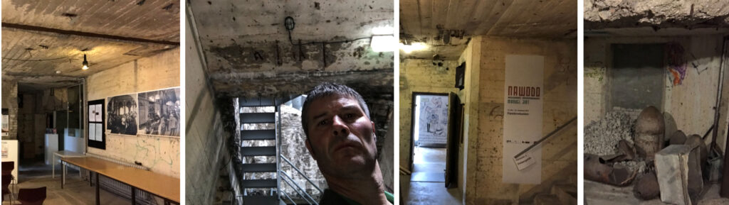
Flandernbunker
The Flandernbunker is one of a number of massive concrete air shelters which have survived, largely due in the first instance to the difficulty in removing them, but latterly because they are a large part of Kiel’s history. This bunker has been converted into a museum, Mahnmal Kilian, commemorating both the bunker itself, and the U-boat shelters that were removed and filled in as part of the redevelopment strategy of the industrial east shore of Kiel Hafen. Minimal glazing has been installed to keep out the elements but as you walk through this impressive art space, studying the artefacts, photographs, films and art installations, a coldness creeps across your skin as you imagine the massive walls shaking under the intense bombardment that the RAF and the USAF released on Kiel as the war entered its bloodiest phase.
Inside Mahnmal Kilian
I’d also arranged to meet one of the curators of the Museum, Steffi Blix, while I was there, and it was great to get the Kiel historian’s insight into the war in Kiel from a German perspective.
As I stepped out of the bunker into the daylight again, I shivered as the bright sunshine slowly warmed me. It was only a stones throw to the northern end of the Keilline, the paved waterfront that runs from the Wik to the centre of Kiel. I’d seen the naval dockyard on the wartime map of Kiel – Tirpitzhafen stirred recognition; who hasn’t heard of the Tirpitz? Both were named after Grand Admiral Alfred von Tirpitz, the architect of the Imperial German Navy.
A heavily disguised Tirpitz at the naval dockyard at Wik in 1941
Modern German warships, part of NATO, now berthed where Hitler’s famous battleships, the Bismarck, the Scharnhorst and the Tirpitz once lay. I tried to imagine the barrage balloons, the multitude of naval vessels, large and small, the throngs of Kreigsmarine personnel, and the air raid sirens, the anti-aircraft guns and the smell of smoke in the air as I walked along the serene waterfront.
Tirpitzhafen in 2017
I stopped at a café, on a wooden pier jutting out into the still waters, grabbing lunch as I gazed out across Kiel Hafen, full of not-so-distant history.
Stirring myself from the view, I crossed the road and climbed up the twisting path that led to the rise of Dusternbrook, even at just 80 feet elevation, one of the higher points on the west shore of Kiel Hafen. The path threaded through a bank of trees into a leafy avenue, lined by large villas of the style popular at the end of the nineteenth century. Presumably the leafier suburbs of Kiel had suffered less during Bomber Command’s campaign, with many of the houses surviving the war.
Oskar von Friedeburg’s house in Dusternbrook
I needed a substantial villa for the General’s friend, affluent businessman Oskar von Friedeburg and, looking around, the well presented residences, with their view across Kiel Hafen and their seclusion, were perfect. I walked along Bismarckallee, imagining the curtains twitching at a stranger in the neighbourhood.
From there, it was short stroll down the hill to the former Kriegsmarine Headquarters, where, in the Sturmtaucher Trilogy, General Erich Kästner had his office, in his role as Liaison officer between the Abwehr, the Reich’s military intelligence organisation, and the German Navy.
Wartime German Naval HQ, now Schleswig-Holsteinischer Landtag
It features heavily in the story; the General’s position allowed him access to a wealth of information which helped in his quest to protect his treasured Jewish employees, and he often met his close friend, and head of the Abwehr, Admiral Wilhelm Canaris, in the building that is now seat of state government for Schleswig Holstein.
Bomb damage to German Naval HQ
There is a marina on the shoreside where there had once been jetties for the various small craft that shuttled to and from the naval HQ to ships anchored in the harbour, or to the boatyards opposite. I had a use for them in the books.
The Keilline continues for another kilometre toward the Innerhafen and Die Horn, the last part of Keil Hafen, right in the centre of the city. Reaching the end of the waterfront promenade, I looked over at the Arsenal Mole, where German naval ships replenish their munitions and supplies to this day, and to the still working Howaldtswerke shipyard next door. The other large shipyard, Krupps, has gone, replaced by a cruise ship terminal; Kiel is a popular destination for the multitude of large cruise ships which ply the Baltic sea.
Little remains of the Kiel of the 1930s on the east shore of Kiel Hafen – the shipyards, and the adjoining districts of Gaarden, Wellingdorf and Dietrichsdorf were largely destroyed by 1945.
Kiel Hafen, 1944, taken from an RAF bomber
After a pause, I continued on to the Fischhalle, the iconic fish market building which miraculously survived, and is now a maritime museum. I’d arranged to meet another historian there, a curator of the museum and an academic at Kiel university.
Fischhalle, Maritime Museum
I was a little early, so I took a look around the museum, and, never one to miss the chance to get afloat, I spent a fascinating half hour aboard the preserved 1902 steam buoy-laying vessel, the Dampfschiff Bussard. Fascinating, and free!
Dampfschiff Bussard
Dr. Julian Freche
Julian Freche, the historian and archivist I’d arranged to meet, was younger than I’d expected, and he gave me a valuable hour of his time, answering questions that were frustrating me in my online research, especially from a maritime perspective. His knowledge and enthusiasm to keep alive the memories of the terrible things that had happened in the city were encouraging, especially when he told me of the lengths the German educational system goes to in making sure the National Socialist’s actions would never be forgotten.
I had a couple more places I wanted to see before dark, so I bade Julian goodbye and hurried along the quayside to Kiel Banhof, the main railway station. Completely destroyed in the bombing, it was rebuilt after the war but in a not dissimilar style. I knew that the railway station would have a place in my books, in fact I’d found a photograph of the Kiel Rabbi, Dr. Akiva Posner, his wife Rachel and their three children at the train station in Kiel in 1933, being seen off by the members of his Shul, emigrating to Palestine in the face of the deteriorating situation for Jewish people and other minorities. He’d warned those Jews who elected to stay in Kiel that life under the National Socialists could only get worse; almost half of them left before the door to emigration was slammed closed.
Kiel Bahnhof, 1945 and 2017
My last visit of the day, and perhaps the most poignant, was to the the Jewish cemetery on Michelsenstraße, which was badly damaged during the bombing of Kiel, but it survived, and is still used by the Jewish community in Kiel which, remarkably, has slowly grown since the end of WW2 and now numbers are much the same as pre-1933 levels at around six hundred. The sign at the entrance said that the cemetery was closed, but the gate was open, and I slipped in through it. I hoped, by writing the story of Kiel’s Jews, I’d be forgiven for the small trespass. As I walked slowly around the older part of the small cemetery, tucked away between apartment blocks, I scanned the names, making mental notes of them; I’d use a mishmash of these in the trilogy. I let myself out, closing the gate behind me.
Jüdischer Friedhof
My route had brought me back to where I had started. As I walked along Lange Reihe and climbed the stairs to the room I’d rented, I could feel the fatigue in my legs, and my feet were sore – it had been a 16 kilometre walk, and anyone who knows me will testify that I’m not a big fan of this form of ambulation.
Lange Reihe
I’d gone some way to getting my head round Kiel as a city, but unlike Glasgow, the city of my birth, or Edinburgh, there was no hill to stand on where I could view the city as a whole, to get a better idea of its layout, and how it all fitted together. Yes, I had caught glimpses of the old Kiel, and I’d begun to have a gut feeling about how the story would fit into the city, but I wanted to see the bigger picture and, in the absence of a high vantage point, I know there was only one other way.
I had to see Kiel from the water.
~~o~~
More detailed maps can be found on the website and you can download my route on Google Maps. Part two, exploring the east shore of Kiel Hafen and the surrounding Districts of Holtenau and Hassee, will be in the next post.
To read Getrud Wronker’s biography, download the PDF copy and paste it into Google or DeepL translate.
After penning three crime novels, the last of which was incredibly well received, I should have continued writing in the crime genre, one per year perhaps, to capitalise on my growing readership.
But I’m a keen sailor, piloting my 45-year-old yacht around the west coast of Scotland and the Irish Sea and, because writing what you know about always seems a good place to start, I felt compelled to publish a book where sailing played a prominent role. I did consider a murder investigation connected with sailing and the sea, and one day I might come back to that concept, but a germ of an idea had wormed its way into my head, and I couldn’t shake it loose.
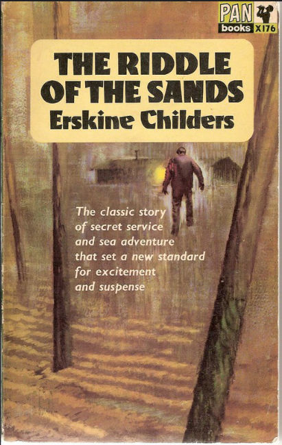
I’d read Erskine Childers’s The Riddle of the Sands as a teenager, and in a way, it was his description of the very ethereal sailing among the tidal mudflats and low islands of the North Sea coasts of Europe in the creeping disquiet just prior to the First World War that intrigued me, but I’d also read numerous books about the Second World War, including many harrowing stories about the Holocaust, both fact and fiction, and a jumble of ideas swirled around in my head, eventually congealing into the narrative that became the Sturmtaucher Trilogy.
And like Erskine Childers, I used the Frisian Islands in my story, and the islands and sheltered seas of the West coast of Denmark. In homage to Erskine Childers, perhaps, I chose to use a traditional wooden gaff-rigged ketch as the iconic vessel, Der Sturmtaucher (The Shearwater in English), the type of vessel that would have been numerous when he wrote The Riddle of the Sands, and similar to Asgard, the last yacht he owned. They were both , Colin Archer ketches, designed as rescue boats for the fishing fleets of Norway.
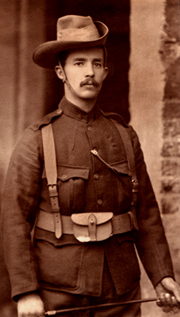
But there’s more to it than that. Robert Erskine Childers was a remarkable man, and his story has far greater depth to it than just his writing.
Childers was born in London, in 1870, to a well to do family, but his father died when he was six years old from Tuberculosis, and his mother passed away six years later. He was sent to his mother’s family on their estate in County Wicklow, Ireland, and along with his four siblings, was treated kindly and grew up loving the countryside of Ireland, as part of the privileged protestant ruling class. He was admitted to Cambridge university on finishing school, and edited the Cambridge Review. Although his cousin, Hugh Childers, worked tirelessly for Irish home rule as a member of the British cabinet, at this point Childers argued vehemently against it in the college debating society.
On leaving university, he became a parliamentary official, with the intention of one day following his cousin into the house as a member of parliament. A sciatic injury sustained as a teenager precluded him from most sports, so he took up sailing, and bought a little yacht, Shulah, which he sailed alone in and around the Thames Estuary, but he sold her, and over the next years, the yachts he owned and sailed grew a little larger and more capable, until he purchased Vixen, a 30-foot cutter in 1897 and sailed her across the North sea to the Frisian Islands, in Holland and Northern Germany, which he repeated over the following few years. It was these voyages that became the inspiration for The Riddle of the Sands.
His sailing was interrupted in 1898 when he joined up to fight in the Boer War, where he was involved in a few significant engagements, but was evacuated from the front line with severe trench foot, and spent a few weeks in hospital in the company of a group of soldiers from Cork, who had enthusiastically signed up to fight with the British, and who were firmly against the growing calls for home rule.
He began writing The Riddle of The Sands in 1901, and it was published in 1903, almost immediately becoming a best-seller. It was largely based on his sailing experiences around the Frisian Islands and predicted the war with Germany and urged that Britain should prepare. It was an influential book – Churchill later claimed that it was a major factor in the British Navy expanding its naval bases in Scotland, at Scapa Flow, Invergordon, and Rosyth.
On a trip to America after the book’s publication, he met American heiress, Molly Osgood, a well read woman with Republican leanings. When they married in 1904, the bride’s father had a 28-yacht, Asgard, built as a wedding present for the couple, and again they cruised to the Frisian Islands. Gradually, Molly’s influence wore down his belief in Britain’s imperial policies, especially in Ireland and South Africa.
Childers was critical of British tactics in the Boer war in a volume of The Times History of the War in South Africa, and he was also scathing about the outdated strategy of the British Army, with the threat of war with Germany looming. It brought him unfavourable attention from the British military establishment. In retrospect, his criticisms were insightful and General Haig’s rejection of them ultimately added to the carnage of WW1.
By 1910, the Erskines had three children, although Henry, their second son, died before his first birthday. By then, his political stance with regard to Ireland had almost completely reversed, and he became a staunch advocate for Irish home rule, writing a book setting out its framework in 1911. The growing power of Ulster Unionism and its unwillingness to even consider home rule for the much wealthier and industrialised northern counties of Ireland made this an almost impossible ambition, and Childers became increasingly frustrated, especially when the Liberal Party, which he’d joined because of its support for Irish home rule, began to backtrack, with talk of excluding some or all of Ulster from their plans.
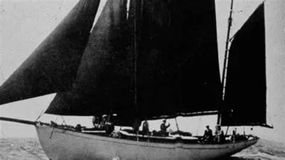
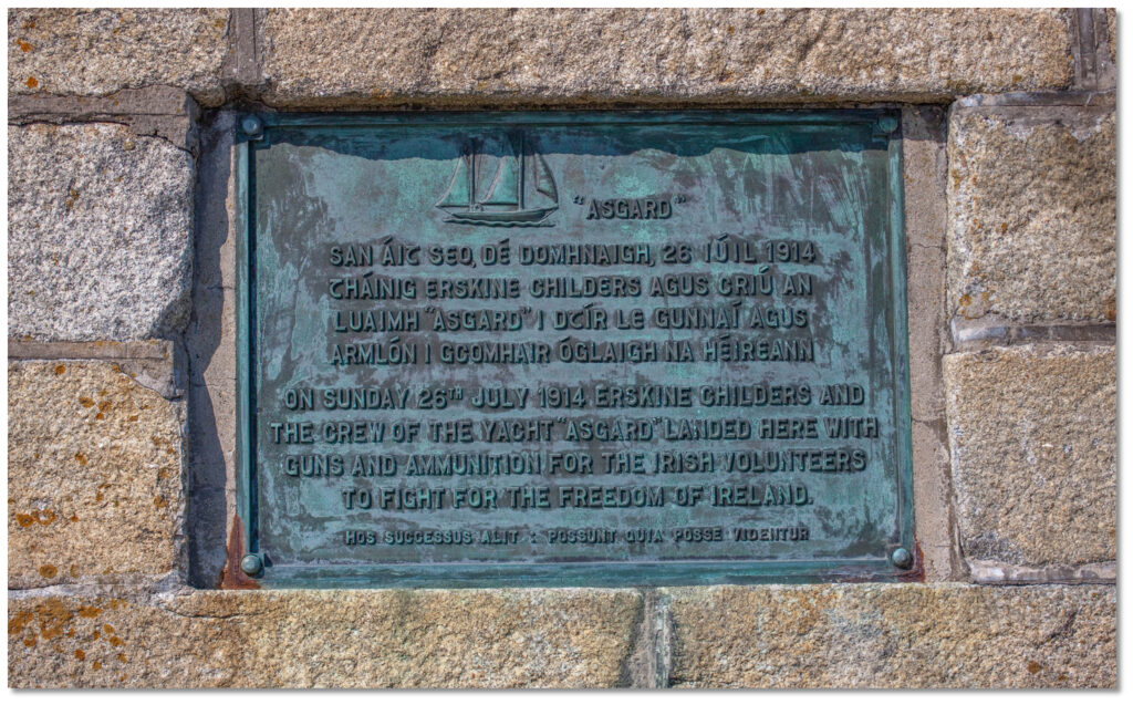
In response to the Ulster Unionists arming themselves with rifles, Childers’ support for Irish Home Rule dramatically deepened, and he used Asgard, his last and most famous yacht, to smuggle guns to nationalist fighters in Ireland. The vessel is now exhibited at The National Museum of Ireland.
Asgard
A bill passed to enable home rule in 1914 was shelved for the duration of the 194-18 war and, despite his support for Irish Nationalism, he volunteered and fought for Britain during the war, earing a Distinguished Flying Cross. A violent crushing of the Irish Easter Rebellion in 1916 hardened Childers attitude to the British Government and, on being demobbed in 1919, convalescing from a severe attack of influenza, he met with the Sinn Féin leadership in Dublin. In 1921 he was elected as a Sinn Féin member to the Irish Dáil, but lost his seat in the 1922 General Election.
When negotiations for the Anglo-Irish Treaty returned a watered down home rule, Ireland was plunged into a civil war, intensified when Michael Collins, the Sinn Féin leader, was assassinated. Childers held various posts with in the Irish Republican movement but was never fully trusted, and was eventually marginalised. He disagreed vehemently with the Treaty’s insistence that the new Irish parliament should pledge allegience to the British King.
During the Irish civil war, he was arrested by the new Irish State he’d campaigned tirelessly for and tried for possession of a firearm, ironically gifted to him by Michael Collins, in contravention of the emergency powers resolution. He was found guilty and sentenced to death. An appeal launched by his lawyer was not heard by the time he was executed by firing squad, at Beggars Bush Barracks in Dublin. Before his execution, he shook the hands of the men who would shoot him and, in his last meeting with his 16-year-old eldest son, Childers he told him find and make peace with every man who had signed his death warrant.
His final words were to the firing squad, when he told them it would make it easier if they took a step closer.
Plaque on Howth harbour wall, near Dublin, in memory of Erskine Childers and Asgard
Erskine Hamilton Childers, Childers’ son, went on to become the fourth president of Ireland.
And the mud flats, the sandbanks, the creeks and the marshes of Denmark and Northern Germany found their way into the Sturmtaucher Trilogy.
Upcoming book festivals in July from the UK\Ireland #bookfestival list. Full list at: https://alanjonesbooks.co.uk/festival_list.html
10-17 @wcorklitfest
Jul 11 @beaconlitbucks
17-19 @FlashFicFest
23-26 @HarrogateFest
Jul 31-Aug 9 @fringebythesea2
This blog does not share personal information with third-parties, nor does it store information it collects about your visit to this blog for use other than to analyse content performance through the use of cookies, which you can turn off at anytime by modifying your Internet browser's settings, or if you sign up to the newsletter. It is not responsible for the republishing of content found on this blog on other websites or media without my permission. This privacy policy is subject to change without notice.